National Route 40 or Ruta Nacional 40, is also called Libertador General Don José de San Martín (anyway it is better known as route 40). It is a highway in Argentina from Cape Vírgenes, Santa Cruz to the border with Bolivia in the city of La Quiaca, in Jujuy. It is a wonderful route with many tourist attractions, which runs parallel to the Andes mountain range, including nearby sections or through several national parks. It is the longest route in the country, crossing it from south to north, and runs through several of the tourist regions and the most important attractions of its territory. The route covers 5194 km starting in Santa Cruz, crosses 21 national parks, 18 important rivers, connects 27 mountain passes and climbs to almost 5000 meters above sea level, in the Acay pass in the province of Salta, in the northwest Argentine, making it the highest route in America, and also the highest in the world outside the Himalayas. Interesting right?
Route 40 is an emblem of Argentina, crossing eleven provinces: Santa Cruz, Chubut, Río Negro, Neuquén, Mendoza, San Juan, La Rioja, Catamarca, Tucumán, Salta and Jujuy. Through it you can access El Calafate, near the Perito Moreno glacier, Esquel, El Hoyo, Lago Puelo, El Bolsón, Bariloche, Villa La Angostura, San Martín de los Andes, Junín de los Andes, Chos Malal, Malargüe, the Wine Route in the provinces of Mendoza and San Juan, dinosaur fossil deposits in the Province of San Juan, hot springs in Catamarca, the Ruins of Quilmes, the Calchaquíes Valleys, the highest vineyards in the world in Cafayate next to the Salta wine route, the La Polvorilla viaduct that is crossed by the famous Train to the Clouds and the Puna. But about the attractions that you visit, we will talk later in greater detail.
Route 40: Frequent Ask Questions
To visit the Ruta 40 is an amazing experience, but you may have some imoprtant questions first. Let´s start with the FAQ´s:
How to visit the Route 40 in Patagonia?
If you are planning to visit the amazing Route 40 in Patagonia, you can rent a car on. And a good idea is to start in any of the head cities with airport, like El Calafate in Santa Cruz Province of Bariloche in Rio Negro Province. There are algo guided tours going from Bariloche to El Calafate and viceversa, with different stops in the destinations along the 40 national route. Other important points of interest are El Bolson and Lago Puelo Nat Park, Esquel and Los Alerces National Park, Bajo Caracoles and the Cave of the Hands, Los Antiguos, El Chalten and the Fitz Roy Massif, El Calafate, Perito Moreno Glacier and Los Glaciares National Park.
Where to stay during your trip in the Route 40 in Patagonia?
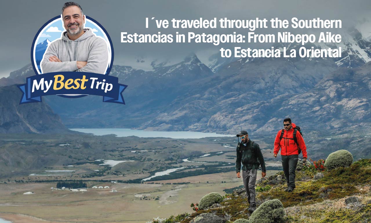
Well, in some big cities like Bariloche, Esquel, El Calafate and El Chalten for example, you can find different accommodation and hotel categories. These are very touristic places, so no problem here. In some small places along the route, you can stop in Estancias which is a wonderful experience.
Why is Route 40 in Patagonia so famous?
National Route 40 in Argentina has a prominent place among the 10 most memorable highways in the world: for the unique amazing landscapes, the total length, the extreme altitude conditions and the variety of regions it runs through. Of course, the most famous part of the route is the Patagonia portion, from the Lakes District to El Calafate, from where you can visit the Perito Moreno Glacier and other amaging glaciers in Los Glaciares National Park.
How long is the Route 40?
Well, in total from La Quiaca in the border with Bolivia, to the extreme south in Cabo Virgenes in the province of Santa Cruz in Patagonia, the route has 5194 km. It´s the largest route in Argentina and one of the largest routes in the world. It´s Amazing isn´t it? From Bariloche to El Calafate, there are a total of 1512 km along the 40 national route.
What is the best time to visit the Route 40 in Patagonia?
Well, definitely it´s not a good idea to go in winter season. You can find snow and extreme weather. Daylight is reduced and temperatures too low. The best season to enjoy the Route 40 in Patagonia is during summer season. But, in general we can say that the October to March period is a good season to visit the Route 40 in Patagonia. Large days, sunshine, good temperatures and definitely no snow in the road.
Is the Route 40 paved or gravel?
It´s an interesting question, because people usually thinks that it´s gravel. But, It’s paved the whole way between Bariloche and El Calafate. So, do not worry!
Is Route 40 very busy?
No, definitely not. Traffic on this highway is very low, with less than 1000 vehicles per day on average, except in two sections: the tourist road between El Bolsón and San Carlos de Bariloche, in the Province of Río Negro, and between Pareditas, in the Province from Mendoza and the City of San Juan. The town of Pareditas is an obligatory step for the transfer of vehicles between the cities of Mendoza and San Rafael.
Except for the aforementioned sections, the circulation is seasonal, since in vast areas of Patagonia the road is interrupted by snow during the winter season, in the months of July to September. The rivers that cross the route in the north of the country suffer large increases in the summer months, interrupting the road in areas where there are no bridges built.
The Route 40 in Patagonia: From Bariloche to El Calafate
Route 40 is extensive, but we propose a route of almost 2500 km so that you can discover the immensity of Argentine Patagonia without any haste to be able to know in depth each section of the road from Bariloche in the lake region, to El Calafate in the province of Santa Cruz.
The Route 40 in Patagonia: Bariloche, El Bolson, Esquel and Los Alerces National Park
San Carlos de Bariloche is an important destination in Patagonia Argentina, a gateway for visiting the Lake District. From there, we return to Route 40 that comes from the north, to cross the provincial boundary (between Neuquén and Río Negro) at the Alicurá dam and we will meet Pilcaniyeu, at the junction with RP 23 that joins the province through the so-called south line, and finally we find Ñorquinco, from where we can take a gravel road and get to El Bolsón, at the foot of the Piltriquitrón hill (you can also access this town by following the 234 from Bariloche).
Continuing our journey along the longest Argentine highway, we cross another interprovincial limit and arrive in Chubut, where the first tourist center is El Maitén and then Leleque, a city that can be reached coming from El Bolsón, passing through the towns of Lago Puelo , El Hoyo and Epuyen. From El Bolson, you can visit Lago Puelo National Park. Lago Puelo NP protects a landscape with very unique characteristics, due to its location and low height above sea level (200 meters above sea level), a particular climate develops that allows the existence of unique plant species representative of the Valdivian jungle such as the olive tree (Aextoxicon punctatum) , ulmo (Eucryphia cordifolia), lingue (Persea lingue), hazel (Gevuina avellana), also species of the Andean-Patagonian forest such as coihue (Nothofagus dombeyi), cypress (Austrocedrus chilensis), lenga (Nothofagus pumilio) arrayán (Luma apiculata) , among others. A characteristic plant species of the Park is the pitra (Myrceugenia exsucca), which finds ideal conditions here to develop in the form of dense forests.
In relation to the fauna, the Park protects species such as the huemul (Hippocamelus bisulcus) native deer in danger of extinction; the pudu (Pudu puda), red fox (Lycalopex culpaeus) puma (Puma concolor) among others. Also noteworthy is the presence of the Monito de Monte (Dromiciops gliroides), a small marsupial categorized as vulnerable in Argentina. Among the birds are the chucao (Scelorchilus rubecula), large churrin (Eugrallaparaxa), the Andean condor (Vultur gryphus), the araucana pigeon (Patagioenas araucana) considered a Vulnerable species, the torrent duck (Merganetta armata), a species considered Threatened, among others.
From El Hoyo we continue in south direction, to arrive at Esquel and Trevelín near the La Hoya ski centre. From Esquel, is a good idea to detour a bit to visit the amazing Los Alerces National Park.
Bordering the neighboring country of Chile, Los Alerces National Park protects lahuán or Alerce forests. Among pristine waterfalls and emerald green lakes, surrounded by younger specimens that make up a thousand-year-old larch tree, emerges the imposing “Grandfather” or “Abuelo” with 2,620 years old and 60 meters tall, it keeps wise advice in each ring of his trunk. Los Alerces National Park was created in 1937 and declared a World Natural Heritage Site by UNESCO in 2017.
The Route 40 in Patagonia: From Esquel to Gobernador Gregores
After visiting Esquel and Los Alerces National Park, we continue our route to the south of the Chubut Province, to arrive to Tecka, Gobernador Costa, Alto Río Senguer and Río Mayo until reaching the last limit with the province of Santa Cruz.
we will access the towns of Perito Moreno and Los Antiguos, the latter located on the south bank of Lake Buenos Aires by Provincial Route No. 43.
Perito Moreno is located at the intersection of provincial routes N °43 and N °45 and National route N °40, it is the head of the Lake Buenos Aires Department and Capital of Rock Art, it constitutes one of the strategic points to visit the Cueva de las Manos , the main archaeological resource of the Province. Due to its location, it is a strategic point to visit the attractions located in the area.
Los Antiguos is a small city in the extreme northwest of Santa Cruz, on the shores of Lake Buenos Aires, which at different months of the year dresses up to receive its visitors. Here fishing, family walks and visits to productive orchards are part of the most attractive activities. This town is the National Capital of the Cherry, and the environment offers a natural spectacle when September begins and the cherry blossoms stain all the farms white. It is from December to the beginning of March when visitors can taste Export Quality Cherries, star of the region. The valley in which Los Antiguos is located is so rich that the range of fine fruit that is produced is a key to visiting each establishment and trying the gastronomy that proposes a journey of exclusive flavors and colors. It is an ideal place for those tourists who seek to rest and perform activities different from the daily routine that is customary in large cities. The proposals to know the local production and life in the farms is for the whole family. The pioneering establishments are an ideal option, while those who seek adventure and activities, Sport Fishing in the Jeinimeni River is a perfect alternative as well as touring the Buenos Aires Lake waterfront, taking lake excursions or visiting Mount Zeballos. In autumn the show is impressive, the intense colors are the backdrop to the production cycle and of course, the town with its history of travelers in the region, has its lodgings and restaurants open all year round, because it is always a good time. to visit Los Antiguos.
After that, we will enter the territory of the Perito Moreno National Park, where we access the second of the world heritage sites: the Cueva de las Manos, located on the Pinturas River. The Cueva de las Manos site is located in the Alto Río Pinturas area in the “Estancia Cueva de las Manos”. It includes the eaves, cliffs and the cave with the presence of cave paintings. The sectors with the most prominent paintings are located on the right bank approximately 88 meters above the river level, covering a front of more than 600 meters. These represent different hunting scenes, hand negatives, animal motifs, and abstract figures. In the Pinturas River Basin, several archaeological sites are located on both banks, these are evidence of an integral occupation of the area by hunter-gatherers over 9000 years.
Another interesting attraction in the area is the Posadas Lake. Lago Posadas is in the northwest of the province of Santa Cruz. To get there, you have to deviate from Route 40, near Bajo Caracoles. There are 75 kilometers of gravel road, heading for the Andes Mountains. Another way to get to the town is from Los Antiguos, along Provincial Route 41, known as Camino de Monte Zeballos. This section can only be traveled in summer and is home to one of the most impressive and varied landscapes in Patagonia. In addition to the attractive landscape, Lago Posadas attracts a good number of sports fishing enthusiasts. In the waters of the two lakes (Posadas and Pueyrredón), in addition to those of the nearby Oro River, there are rainbow trout, brown trout, salmon, perch and Patagonian silverside. This is precisely the reason that makes the Lake Posadas area a paradise for fishermen seeking almost virgin destinations. Near the town, Mount San Lorenzo rises, which at 3,700 meters is the highest in the province of Santa Cruz. Its ascent is a challenge for seasoned climbers, and a harsh climate has ensured that very few people have been able to complete the journey to the top. Another attraction of this unexplored area comes from its history. The town of Lago Posadas was born from the meeting point between dispersed families in rural establishments in the area.
Next step is Gobernador Gregores, a city of approximately 7000 inhabitants, it is the administrative headquarters of the Perito Moreno National Park, and a distribution center for those who like sport fishing, since in its vicinity are Lake Cardiel and the renowned Lake Strobel, also known as Jurasic Lake, by international fishermen. The center of the city has buildings of historical value and some historical points linked to the strike of 1921 are also of interest, such as Cañadón de los muertos. From Gobernador Gregores, you can visit the Perito Moreno National Park. Turquoise water lakes with the bottom of the Andes mountain range represent the characteristic landscape of this protected area. Of the eight lakes of glacial origin, only one empties into the Atlantic Ocean. The rest dump their waters towards the Pacific. In the steppe, the coirón shrubs and grasslands dominate the landscape in which a series of lagoons have formed. Ducks, geese and flamingos take refuge there. In the Patagonian forests, the lenga is the main tree species, accompanied by the ñire.
The fauna is represented by mammals such as the orange chinchillón, the guanaco, the huemul, the puma, foxes and piches. Among the birds it is possible to see the short rhea, the ashen plover and condors. An amphibian, the Lake Nansen frog, populates the area, and the lakes are found in puyenes and peladillas. The area contains important evidence of ancient human occupations in the form of eaves with cave paintings and other archaeological remains.
The Route 40 in Patagonia: From Gobernador Gregores to El Chalten and El Calafate
Following the route to the south, you reach the access to El Chaltén, taking the junction with Provincial Route No. 31 in the city of Tres Lagos. This town is located within the Los Glaciares National Park and it´s the gate to visit and enjoy trekking activities to the unique Fitz Roy Mount.
El Chaltén is a small village in the west of the province of Santa Cruz, Argentina. It is located in the south of the Andes mountain range, in the extreme southwest of Argentine Patagonia, at the foot of Cerro Fitz Roy -or Chaltén- and on the banks of the Río de las Vueltas. It is a small tourist village founded in the Los Glaciares National Park. El Chaltén was declared the National Capital of Trekking on July 28, 1994. There are many different trekking trails, so a good idea is to stay in El Chalten for a few days to enjoy these activities. Then, the route continue to El Calafate.
The town of El Calafate is located on the southern shore of Lake Argentino, and is the only access point to the Perito Moreno Glacier, declared a World Heritage Site. This city shares with the city of El Chaltén Los Glaciares National Park, which protects internationally recognized glaciers and at the same time offers the greatest diversity of activities in Santa Cruz. There you can practice from trekking on the glacier, navigations, visits to footbridges, to adventure activities in 4×4 and horseback riding. In the city you can visit museums, ice bars, chocolate shops. Here, traditional gastronomy has an important development and the emblematic element is the Patagonian lamb, a dish that cannot be missing from your agenda of things to enjoy.
Of course, the Perito Moreno Glacier is the highlight in the area, but there are many other great activities to enjoy in the area, as different boat navigations in the Argentino Lake or the famous minitrekking to walk over the ice of the glacier.
Tour visiting Route 40 in Patagonia: From Bariloche to El Calafate
DAY 1. BARILOCHE – LOS ALERCES NATIONAL PARK Torrecillas Glacier – Los Alerces National Park
We leave Bariloche to take Route 40 south, bordering the Gutiérrez and Mascardi lakes to reach El Bolsón, a quiet town at the foot of the Piltiquitrón hill. If it is open we will take a walk through its colorful handicraft market, the best in Patagonia. After buying something to eat we continue on our way, passing through Cholila and Villa Rivadavia, two rural villas located in the valley of Lake Rivadavia. From there we will arrive at the north portal of Los Alerces National Park. Once inside the park we will skirt the Rivadavia, Menéndez and Futalaufquen lakes, making several stops. If you wish, we can take a walk of about two hours crossing the Arrayanes river and continuing through the Menéndez and Verde lakes, where we can admire the magnificent flora of the park and the incredible blue and green colors of the lakes and the river. Night at Villa Futalaufquen, a small villa within the national park. Distance: 315 Km.
DAY 2. LOS ALERCES NATIONAL PARK – CUEVA DE LAS MANOS ESTANCIA Percey River Valley
From Los Alerces National Park we head to the town of Esquel, passing through the beautiful valley of the Percey River. In Esquel we return to Route 40 towards the immensity of the Patagonian steppe. As Route 40 advances southwards it also veers towards the center of the province of Chubut, and after passing the towns of Tecka and Gobernador Costa, the steppe landscape of coirones and grasslands is practically transformed into a desert, with only some hard, flat bushes. In the middle of the afternoon we will arrive at the town of Río Mayo, located in the Department of Río Senguer, famous for its sheep ranches producing excellent quality wool. After passing Río Mayo we will arrive at the city of Perito Moreno, where we will make a brief stop before continuing along Route 40 to the Estancia Cueva de las Manos, where we will spend the night. Distance: 650 km, asphalt and gravel.
DAY 3. CAVE OF THE HANDS – LOS ANTIGUOS
Cueva de las Manos From the estancia you can reach the formidable Pinturas River Canyon. Taking a one-hour walk you can descend the canyon, cross the river and ascend on the other side, where the Cueva de las Manos is. The canyon walls house cave paintings from four different periods between 9,300 and 1,300 years old, being one of the oldest artistic manifestations of the original peoples of South America. The place was declared a World Heritage Site by UNESCO in 1999. If you prefer not to walk, you can reach the cave with the vehicle, traveling an unpaved road lasting one hour from Route 40. After visiting the paintings we return to Perito Moreno and after a brief stop we will deviate 65 km west to Los Antiguos, on the shores of the immense Lake Buenos Aires, where we will spend the night. Distance: 180 km, gravel and asphalt.
DAY 4. LOS ANTIGUOS – LAGO POSADAS
The “stone arch” in Lake Posadas From Los Antiguos we take the Camino del Monte Zeballos, a 160 km unpaved scenic route that covers four different environments: steppe, Andean forest, high prairies and high mountains . Ascending from an altitude of 200 m to 1,500, you reach a viewpoint with spectacular views of Mount Zeballos. Then we will go down to Lago Posadas, with enough time in the afternoon to explore the spectacular Posadas and Pueyrredón lakes, surrounded by impressive rock formations. Night in Posadas lake. Distance: 240 Km.
DAY 5. LAGO POSADAS – PERITO MORENO NATIONAL PARK
Belgrano Lake, Perito Moreno National Park From Posadas Lake we travel 75 km without asphalt to Route 40, and then 160 km further south to the exit to Route 37, which leads to the Perito Moreno National Park, one of the most splendid places in the Southern Andes, and one of the least visited, due to its isolation and harsh climate. After traveling 90 km without asphalt, we will reach the entrance of the park, and 10 km later to Estancia La Oriental, where we will spend two nights. In the afternoon we will make a first tour inside the park, going to Lake Burmeister, of exceptional beauty. Distance: 275 km, gravel and asphalt.
DAY 6. PERITO MORENO NATIONAL PARK
Guanacos in the lagoons of Mié, PN Perito Moreno We spend a full day in the Perito Moreno National Park, to explore in detail its exceptional landscapes, where the wildest nature reigns. We will have time to contemplate the beautiful Patagonian steppe of grasslands of coirón, neneo and calafate and also areas of lenga forest, the higher the more stunted and shaped like a flag, product of the strong prevailing winds. Regarding the fauna, we will be able to see large herds of guanacos, as well as choique, red fox, Patagonian piche, Andean condor, woodpeckers, black eagle, geese, black-necked swans and flamingos, among many other birds. They are also present in the park, although they are very difficult to see, the puma and the huemul, the native deer of Patagonia, strongly threatened and that has one of its last strongholds in the park. We can do different Lago Belgrano, PN Perito Morenorecorridos, among which the ascent to Cerro León, the walk through the Belgrano Peninsula, or the walk to the Lácteo river and the lake stand out. Night at Estancia la Oriental.
DAY 7. PERITO MORENO NATIONAL PARK – EL CHALTÉN Cerro Fitz Roy, El Chaltén
Back on Route 40 we cross the immense plateau to Gobernador Gregores, where we will stop for a quick lunch. Then the pavement ends and we will do almost 80 km of dirt road (gravel), with spectacular views of Lake Cardiel. Back on the pavement, we will reach Tres Lagos and then deviate in the direction of El Chaltén, the Argentine capital of trekking, with innumerable attractions for mountaineers and climbers. The most iconic peaks are the Fitz Roy (3,405 m) and Torre (3,102 m) hills, which attract climbers from all over the world due to their extreme technical difficulty. If the weather conditions are good, this section of the route offers magnificent landscapes, with impressive views of the Fitz Roy massif and the Viedma glacier, both in Los Glaciares National Park. Night in El Chaltén. Distance: 515 Km.
DAY 8. TREKKING IN EL CHALTÉN Laguna Torre, El Chaltén
We spent a day in EL Chaltén, trekking in one of the most beautiful places in the world for it. There are all kinds of options depending on the physical condition of each one, from easy hikes such as the Cóndores and Águilas viewpoints (2 hours), moderate hikes such as the Torre lagoon (7 hours), to the Los Lagoon. Three (9 hours) or to the Pleasure Tumbado viewpoint (9 hours). Other longer options take several days such as trekking to the Torre glacier or the Marconi pass, with indescribable views of the Southern Ice Field. Night in El Chaltén.
DAY 9. EL CHALTÉN – EL CALAFATE – PERITO MORENO GLACIER Perito Moreno Glacier Early in the morning we leave El Chaltén to travel the 215 km to El Calafate, the gateway to the most famous glacier in the world, the Perito Moreno. Along the way we will enjoy excellent views of the Viedma lake and glacier, the La Leona and Santa Cruz rivers and the Argentino lake. Upon arrival in El Calafate, we check into our hotel and go directly to Los Glaciares National Park, where we will spend the afternoon contemplating the Perito Moreno glacier. Walking along the walkways located at different levels, we will enjoy excellent views of the glacier, which is 5 km wide and has an average altitude of 74 m. Night in El Calafate. Distance: 375 Km.
DAY 10. EL CALAFATE – LOS GLACIARES NATIONAL PARK Los Glaciares National Park We spend a full day in El Calafate to fully enjoy Los Glaciares National Park doing an activity of your choice. Our recommendations are sailing on a catamaran on Lake Argentino to see the Spegazzini and Upsala glaciers, a mini-trek on the Perito Moreno glacier or a visit to Estancia Cristina, where we can also go up in 4 × 4 to the Upsala glacier viewpoint. , with views of the Southern Patagonian Ice Field and visit the ranch, the chapel and the museum. Return to El Calafate and end of our services. Night in El Calafate. Distance: 160 km.
DAY 11. EL CALAFATE After breakfast, transfer out to airprot.