The Calchaquí Valleys: A Journey Through Argentina’s Andean Northwest
If you’re planning a trip to Northwest Argentina, you’ve probably come across the name Calchaquí Valleys. These valleys are one of the most breathtaking regions in the country, filled with colorful hills, charming villages, and a rich cultural heritage.
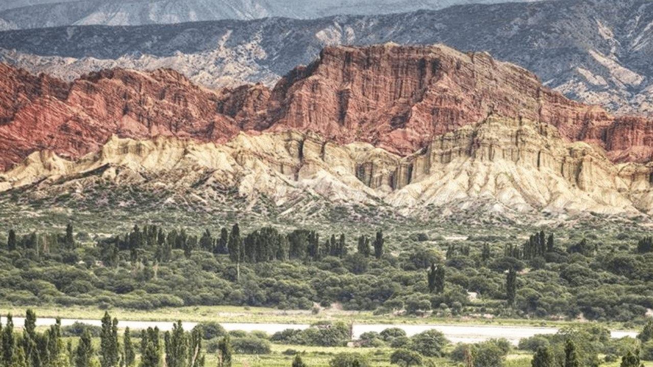
The Calchaquí Valleys stretch across three provinces: Salta, Tucumán, and Catamarca. Covering around 21,000 km², they feature a mix of green valleys, sandy deserts, and dramatic mountains. The area is known for picturesque landscapes, archaeological sites, and indigenous traditions that continue to this day.
Local communities preserve ancestral customs, visible in their ceramics, textiles, leatherwork, and handcrafted instruments. Many of these crafts reflect the Calchaquí culture that predates the Spanish arrival.
Today, the valleys also stand out for their high-altitude vineyards. Introduced by the Spanish, viticulture has flourished here. Wines like Torrontés from this region have received international acclaim. Be sure to explore the famous Wine Route in Salta.
What Are the Calchaquí Valleys?
This spectacular region can be explored on a circular route from the city of Salta, covering towns such as Molinos, Cachi, Cafayate, San Carlos, Seclantás, Animaná, Angastaco, La Poma, and Payogasta.
Some of the most popular experiences in the area include:
-
Cultural tourism
-
Wine tourism
-
Rural and community-based travel
-
Religious and adventure tourism
The area sits at over 2,000 meters above sea level, offering more than 500 km of unique scenery, each section with its own identity.
Where Are the Calchaquí Valleys?
The valleys form a long corridor through:
-
Central Salta
-
Western Tucumán
-
Northeastern Catamarca
They run for approximately 520 km, offering a deep dive into the geography and culture of Northwest Argentina.
Visiting the Calchaquí Valleys from Salta
Start from Salta city and head south on National Route 68 toward Cafayate. The road is fully paved and takes you past several interesting spots:
-
Coronel Moldes
-
Cabra Corral Dam (great for water sports and fishing)
-
Guachipas, known for cave paintings
-
Alemanía, an old railway stop
-
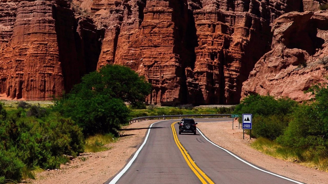
Quebrada de las Conchas, a natural wonder with dramatic rock formations
This stretch ends in Cafayate, a perfect place to spend the night and explore.

Quebrada del Río de las Conchas
Before arriving in Cafayate, you’ll pass through this famous ravine. Don’t miss:
-
The Amphitheater
-
The Toad, The Friar, The Obelisk, and The Castles
-
Sand dunes near Cafayate
These formations are the result of millions of years of water and wind erosion. The Amphitheater even hosts concerts thanks to its natural acoustics.
Cafayate: The Heart of the Calchaquí Valleys
This town is surrounded by vineyards and is a major center for high-altitude winemaking. It’s known for:
-
Torrontés wine
-
Museo de la Vid y el Vino, a modern wine museum
-
Wineries close to the town center
Cafayate is also the best base to explore the valleys, offering excellent hotels and services.
Vineyards here reach up to 3,100 meters in altitude, among the highest in the world. While Torrontés is the star, other varieties include Malbec, Tannat, Bonarda, and Tempranillo.
Cafayate: Heart of the Valleys
Cafayate is the main tourist hub of the Calchaquí Valleys, surrounded by vineyards and home to around 15,000 people. It’s a great place to:
-
Taste Torrontés wine
-
Visit the Museum of Vine and Wine
-
Explore nearby wineries (some at 3,100 meters above sea level!)
Although introduced by Jesuit missionaries in the 1700s, local winemakers have refined techniques and added varietals like Malbec, Tannat, Bonarda, and Tempranillo.

Cafayate: Where to Stay?
The Viñas de Cafayate Wine Resort
One of the best options to stay in Cafayate is the beautiful Viñas de Cafayate Wine Resort, a hotel located right in the middle of the vineyards with incredible mountain views. Staying here for a couple of nights is a great idea. You can relax by the swimming pool overlooking the vines, enjoy the local gastronomy, and visit nearby wineries.
For more about Viñas de Cafayate Wine Resort, check out our interview with a hotel representative!

From Cafayate to Cachi and Molinos
Leaving Cafayate, you’ll head toward Route 33 and pass through Chicoana, where the Calchaquí Valley journey truly begins. You’ll go from green valleys to the Puna, crossing the Quebrada del Escoipe, ascending the winding Cuesta del Obispo, and reaching Piedra del Molino at 3,348 meters above sea level.
After that, you’ll drive through the Recta del Tin Tin and Los Cardones National Park until you arrive in Cachi—an ideal town for an overnight stay before continuing to Molinos.
Piedra del Molino
Located at 3,348 meters, Piedra del Molino offers one of the most stunning viewpoints in the region. From here, you can admire how Route 33 zigzags through the mountains below. You’ll also find the San Rafael chapel and the large grinding stone that gives this spot its name.
Cuesta del Obispo & Recta del Tin Tin
The Cuesta del Obispo is a winding stretch of road connecting the Lerma Valley with the Upper Calchaquí Valley. This dramatic ascent climbs from 1,270 to 3,340 meters, offering breathtaking views and often a chance to spot condors soaring nearby.
Then comes the Recta del Tin Tin, a nearly perfect 19 km straight line at almost 3,000 meters above sea level. Built by the Incas using bonfires as markers, this section crosses Los Cardones National Park and showcases fields of giant cacti and, sometimes, grazing guanacos.
Los Cardones National Park
Located in Salta, this park spans 64,000 hectares and includes three ecoregions: Altos Andes, Monte de Sierras y Bolsones, and a small section of the Yungas.
-
It has the highest diversity of cacti in the country.
-
Hosts endangered species like the Andean cat and red fox.
-
Home to archaeological remains, misty grasslands, and oases.
Access is via Routes 68 and 33 from Salta, reaching either Piedra del Molino or Payogasta.
Cachi
Set at 3,000 meters above sea level, Cachi is a charming town surrounded by snowy peaks and cardones. It’s rich in archaeological history and offers stunning natural surroundings.
What to see in Cachi?
-
Church of Cachi: A 16th-century National Historic Landmark with cardón wood ceilings.
-
Pío Pablo Díaz Archaeological Museum: A journey through 10,000 years of history in the Calchaquí Valley.
-
Route 40: One of the world’s most scenic roads, leading to places like Abra del Acay (4,895 meters).
-
Nevado de Cachi: A nearly 6,400-meter mountain, ideal for mountaineering adventures.
The Calchaquies Valleys: Cachi
Surrounded by snow-capped peaks and cardones and at 3,000 meters above sea level, Cachi is a special town where rich archaeological remains, witnesses of ancient civilizations, are combined with an incredible natural landscape. Its old Church, its perfectly preserved houses and its stone streets give a special charm to this magical town of Calchaquí.
From Cachi to Molinos
Located 45 km from Cachi, Molinos is a peaceful village with a historic vibe. Its 18th-century church holds the mummified remains of Nicolás Severo de Isasmendi, the last royal governor of Salta.
The church is a National Historic Monument, although it’s currently at risk due to erosion and saltpeter near the river.
From Cachi to Molinos
Molinos is located 45 km from Cachi. It´s a beautiful small town with an an old church, and a house from the XIX Century, transformed into an elegant inn. The Church of Molinos, consecrated to San Pedro de Nolasco, houses the mummified remains of the last royal governor of Salta, Nicolás Severo de Isasmendi, who ordered it to be built at the end of the s. XVIII. The church belonged to the encomienda before it passed to the ecclesiastical curia in 1760. In 1826 Molinos was named a parish. It has a single nave with two side chapels as a transept and a choir. It has rich and ancient imagery. In 1942 it was declared a National Historic Monument. It is preserved restored, although it is in danger of disappearance given its proximity to the river and the large amount of saltpeter on its walls.
Quebrada de las Flechas
A highlight of Route 40, this lunar-like landscape in the Angastaco Natural Monument features rock formations that resemble arrow tips jutting from the earth.
-
Rocks reach up to 50 meters in height.
-
Colors range from ash gray to reddish ochre.
-
Light and shadow change the appearance throughout the day.
It’s a surreal, unforgettable stop in the heart of the Calchaquí Valleys.

Other amazing activities and excursions in Salta
We have many options to discover Salta, Jujuy, and the Argentinian northwest.

More activities and excursions in Salta? Click here and see a complete list of options
Buy the Salta Travel Pass and get special discounts!
If you’re looking for a package of activities, you can buy any of our Salta Pass and save money. Check some great options by clicking in the image below:

Tours to visit the Argentinian Northwest
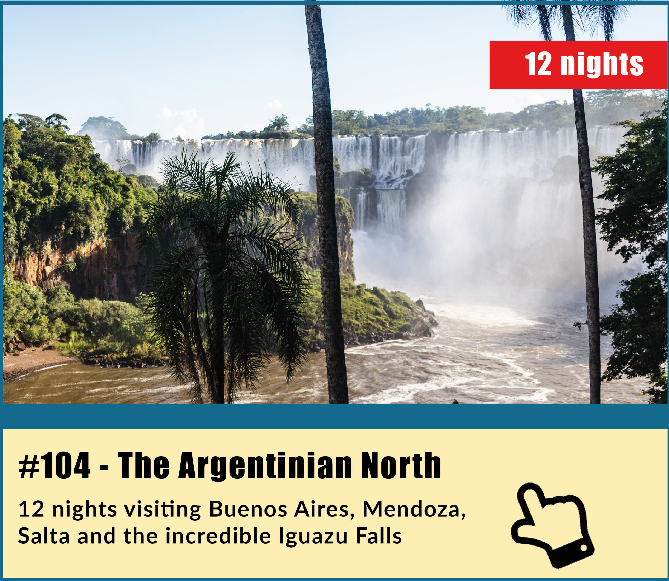
We have a great variety of tours to visit these amazing places, most of them including Salta, Jujuy and the Northwest in general, combined with many other amazing destinations in Argentina such El Calafate, Ushuaia, Iguazu Falls, Mendoza, Bariloche… Check one of my favorites, the 104 tour; The Argentinian North in 12 amazing nights
Tours to visit the Argentinian North and other amazing destinations
Check a complete list of tours to enjoy Salta, the Northwest and other destinations in Argentina by clicking here or in the image below

For more information, just contact us at info@ripioturismo.com
Thank you!