The Humahuaca Canyon
The Quebrada de Humahuaca is a stunning Andean valley in northwest Argentina, located in the province of Jujuy, about 1,500 km from Buenos Aires. It stretches over 155 km, carved by the Río Grande and flanked by high mountain ranges. The entire region sits above 2,000 meters in altitude.
This unique destination blends dramatic landscapes with ancient cultures. The Indigenous communities here still preserve their religious traditions, festivals, art, music, and agricultural practices, which led UNESCO to declare the canyon a Cultural Heritage of Humanity in 2003.
How to Get to the Humahuaca Canyon
-
By road: Take National Route 9 (RN9), part of the Pan-American Highway, connecting Buenos Aires and La Paz.
-
By air: Fly to Salta or Jujuy and travel by land to Humahuaca (approx. 176 km from Salta or 146 km from Jujuy).
-
Scenic routes: Enter via San Antonio de los Cobres and cross the Salinas Grandes to reach Purmamarca, which is a less crowded and incredibly scenic alternative.
There are other off-the-beaten-path routes, but for most travelers, the RN9 or the scenic route via Salinas Grandes are the best options.
A UNESCO World Heritage Site
In 2003, UNESCO recognized the Quebrada de Humahuaca as a Cultural Landscape, a category that highlights both natural and cultural significance. The canyon is part of the ancient Inca Trail, and it has served as a commercial route for over 10,000 years.
You’ll find traces of:
-
Prehistoric hunter-gatherers
-
Inca-era ruins
-
Republican independence struggles
UNESCO’s declaration encourages the preservation of native cultures and the promotion of sustainable tourism.
History and Culture
Humahuaca’s people have deep ancestral roots. Most are of the Coya ethnic group, and many still speak Quechua. The canyon has been home to cultures dating back 10,000 years, including the Omaguacas, who gave the place its name.
Even today, you’ll find a living culture that honors Pachamama, the sun god, and other Andean deities.
What “Humahuaca” Means
-
In Aymara: “Sacred water”
-
In Quechua: “Uma” = head and “Huaca” = sacred place
Weather and Best Time to Visit
The canyon ranges from 1,600 to 4,500 meters in altitude. The climate is dry and windy, with cold nights and hot days.
-
Summer (Nov–Mar): Rainy season; avoid due to possible landslides.
-
Winter: Sunny but cold.
-
Best seasons: Spring and autumn are ideal—mild, sunny, and dry.
Bring sun protection, long sleeves, and warm clothes for the cold nights.
Towns and Attractions Along the Canyon
The Quebrada de Humahuaca can be explored from south to north, beginning in Volcán and ending in Tres Cruces.
Volcán
-
First town in the canyon (2,000 m.a.s.l.)
-
Named after summer mudflows (“volcanoes”) from the hills
-
Visit the Pucará of Volcán, a pre-Hispanic fortress with over 600 enclosures
Tumbaya
-
Located at 2,100 meters
-
Home to the Mudejar-style church, a National Historic Monument
-
Pre-Hispanic roots, known as “Tunpaya”
Purmamarca
-
Elevation: 2,350 meters
-
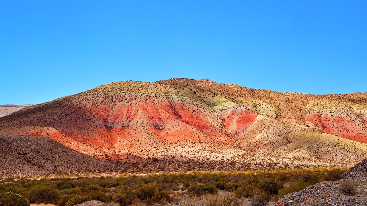
Famous for the Hill of Seven Colors
-
The town and Santa Rosa de Lima church are both National Historic Sites
Maimará
-
Elevation: 2,390 meters
-
Known for the Painter’s Palette (Paleta del Pintor), a colorful geological formation
-
Visit the colonial church, the old flour mill, and pre-Columbian ruins
Tilcara
-
Elevation: 2,465 meters
-
Home to the Pucará de Tilcara, a fortified pre-Hispanic village
-
Visit the Church of the Virgin of the Rosary, a National Historic Monument
-
Don’t miss the Eduardo Casanova Archaeological Museum
Tropic of Capricorn Monument
A marker here indicates the southernmost point where the sun is directly overhead during the summer solstice.
Huacalera
-
Located at 2,641 meters
-
Visit the Chapel of Our Lady of Candelaria, a National Historic Monument
-
Explore pre-Hispanic ruins like La Huerta and Campo Morado
Uquía
-
Elevation: 2,824 meters
-
Known for its baroque church with the Nine Arquebusier Angels paintings
-
Visit the old mill and the Pucará de Chijra
Humahuaca
-
Elevation: 2,942 meters
-
Founded in 1591, declared a National Historic Site in 1975
-
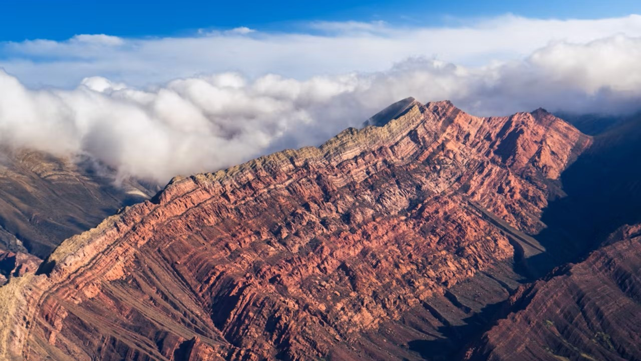
Offers access to the nearby Serranía del Hornocal, the 14-Color Hill
Serranías del Hornocal (14-Color Hill)
-
Located 25 km from Humahuaca
-
Altitude: 4,761 meters
-
Famous for its vibrant, triangular rock formations created by erosion
-
Can be reached via gravel road—accessible by car or guided tour
From Humahuaca to Tres Cruces
-
Explore pre-Columbian sites like Pucará de Peñas Blancas and Churquiaguada
-
Discover petroglyphs at Cerro Negro
-
Final town: Tres Cruces, the gateway to the Puna at 3,693 meters

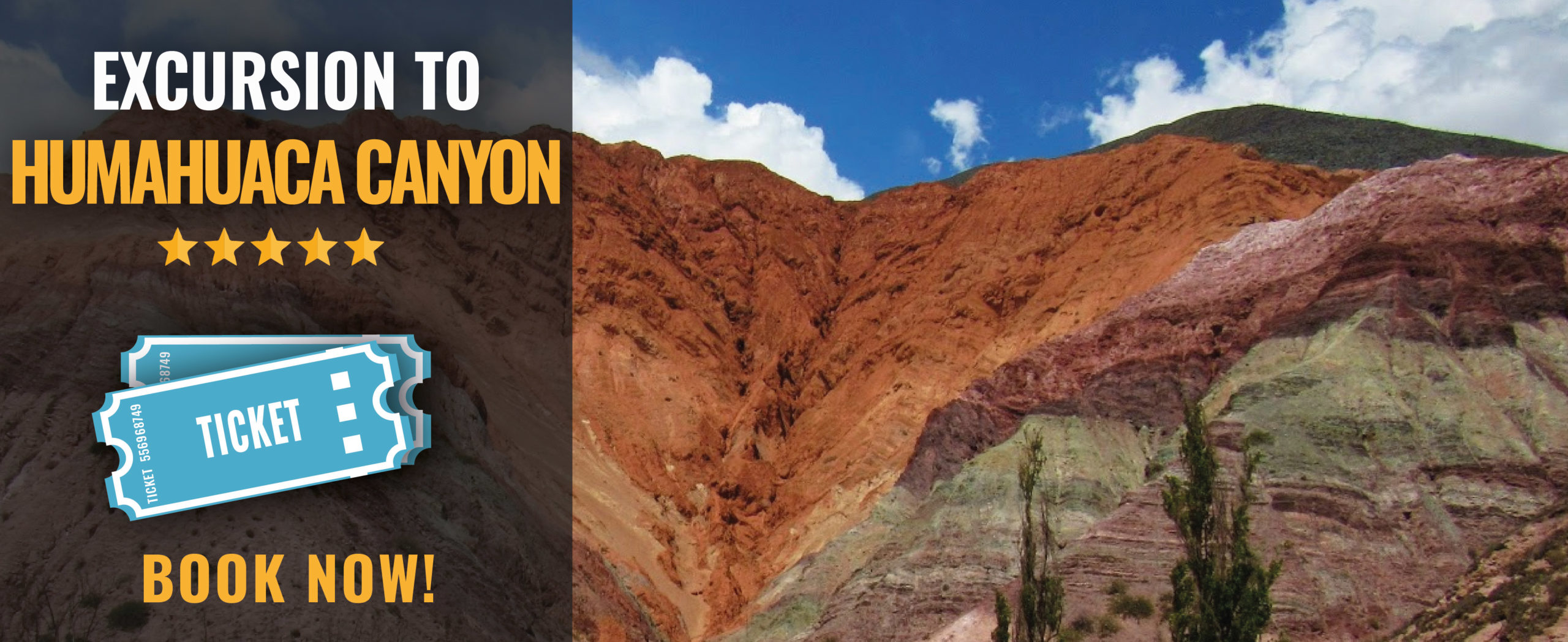
Want to book an excursion to Humahuaca Canyon from Salta?
If you want to book an excursion to Humahuaca Canyon from Salta, just click on the image below
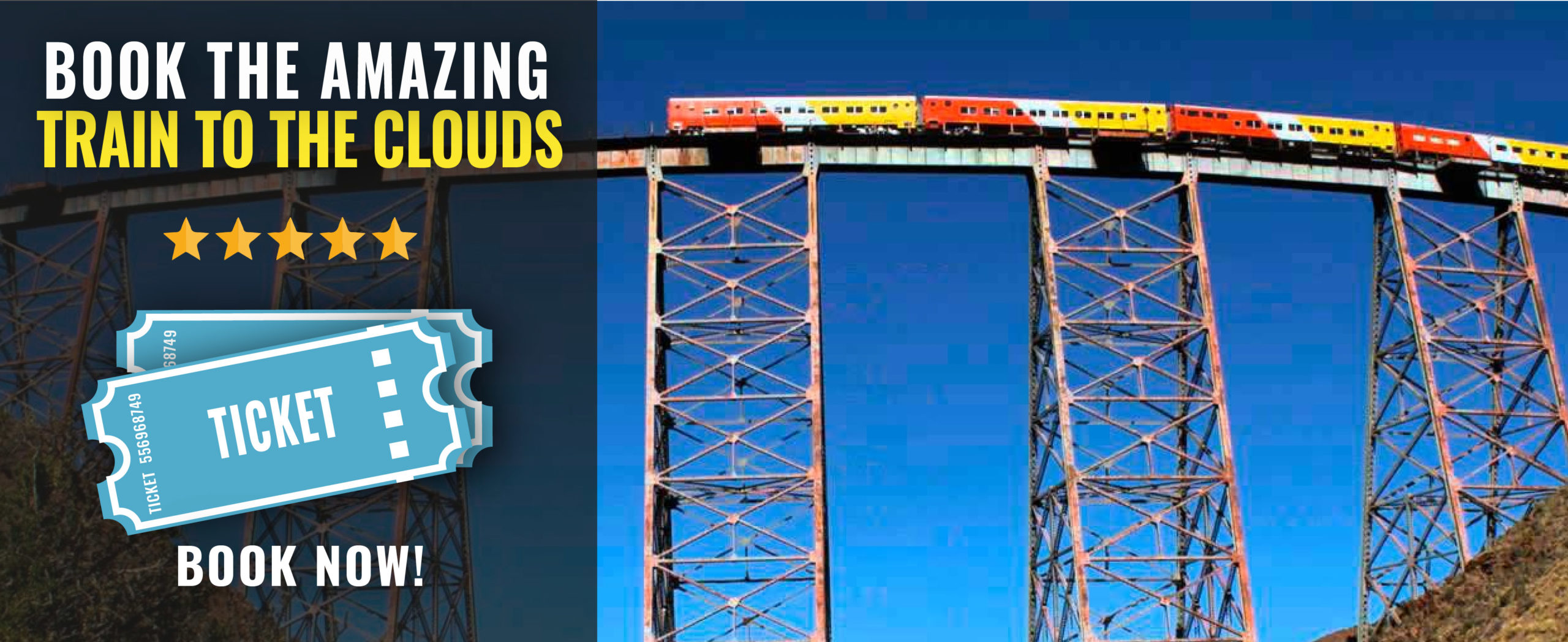
Other amazing activities and excursions in Salta
We have many options to discover Salta, Jujuy, and the Argentinian northwest. These are two of the most interesting, but we have many.

More activities and excursions in Salta? Click here and see a complete list of options
Buy the Salta Travel Pass and get special discounts!
If you’re looking for a package of activities, you can buy any of our Salta Pass and save money. Check some great options by clicking in the image below:

Tours to visit the Argentinian Northwest
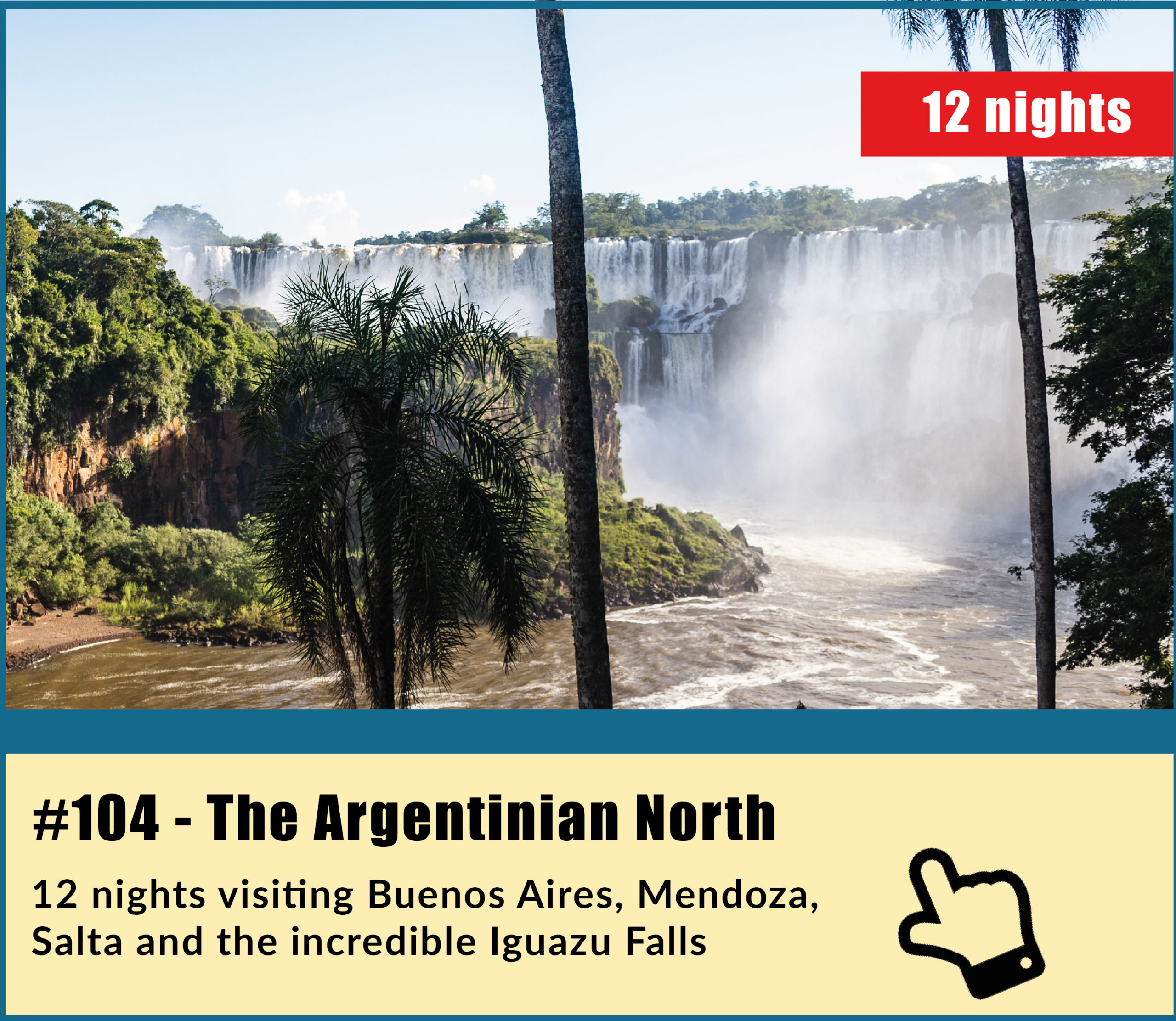
We have a great variety of tours to visit these amazing places, most of them including Salta, Jujuy and the Northwest in general, combined with many other amazing destinations in Argentina such El Calafate, Ushuaia, Iguazu Falls, Mendoza, Bariloche… Check one of my favorites, the 104 tour; The Argentinian North in 12 amazing nights
Tours to visit the Argentinian North and other amazing destinations
Check a complete list of tours to enjoy Salta, the Northwest and other destinations in Argentina by clicking here or in the image below

For more information, just contact us at info@ripioturismo.com
Thank you!