The Inca Trail to Machu Picchu
The Inca Trail is one of the most famous hiking routes in South America. It’s known for its original Inca architecture, archaeological sites along the way, and the natural beauty of the jungle and cloud forest. It’s also the most spectacular way to reach Machu Picchu.
A bit of history
The trail, known as the Capaq Ñan, was built by Emperor Pachacuti to connect Cusco with Machu Picchu. It was rediscovered by Hiram Bingham in 1911 and opened for trekking in the 1970s by Peruvian archaeologist Víctor Ángeles. Today, thousands of travelers come to Peru each year to hike this route.
Best Time to Hike the Inca Trail
The best season to hike is from May to December, especially from June to August, which is dry season. Avoid hiking from January to March due to heavy rain and landslides.
-
Day temperatures: around 23°C
-
Night temperatures: close to 0°C
-
High season: May to September (permits sell out early)
Booking in advance is highly recommended to secure a spot and possibly get a lower price.

Inca Trail Itinerary
Day 1 – KM 82 to Wayllabamba
The journey starts at km 82 of the railway from Cusco. After registration, the hike begins with a crossing of the Cusichaca bridge.
-
Visit Patallaqta, an archaeological site with over 100 structures
-
Lunch near Miskay
-
Hike through Kusichaca Valley to Wayllabamba Camp (3,000 m)
-
Enjoy stargazing at night
Day 2 – Wayllabamba to Paqaymayo
This is the most challenging day, with a steep ascent to the Warmiwañusca Pass (4,200 m), also called “Dead Woman’s Pass”.
-
Pass through Llulluchapampa, a good rest stop
-
Enjoy panoramic views at the summit
-
Descend to Paqaymayo Camp to rest
Day 3 – Paqaymayo to Wiñay Wayna
This is the longest and most scenic day.
-
Hike to Runkurakay Pass (3,950 m)
-
Visit Sayaqmarka, Phuyupatamarca, Intipata
-
End at Wiñay Wayna Camp, where you can shower and visit nearby ruins
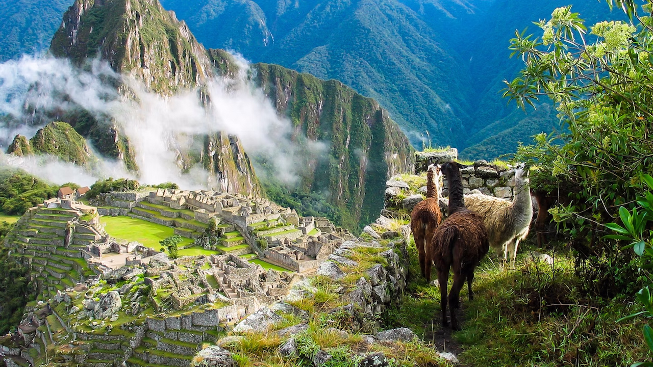
Day 4 – Wiñay Wayna to Machu Picchu
The day starts early around 5:30 AM. After a short hike, you’ll reach the Sun Gate (Intipunku) for your first view of Machu Picchu.
-
Short hike from the Sun Gate to the citadel
-
Spend time exploring Machu Picchu
-
Take it slow to appreciate the beauty along the trail

Highlights of the Inca Trail
-
Wiñay Wayna: Beautiful ruins surrounded by orchids and terraces
-
Phuyupatamarca: “Town above the clouds” with incredible views
-
Sayacmarka: Intricate ruins perched on a cliff
-
Dead Woman’s Pass: The highest and most iconic point of the trail
Tours to Visit Cusco, Machu Picchu, and Beyond
We offer fantastic tours that include:
-
Cusco
-
Machu Picchu
-
Puno and Lake Titicaca
-
La Paz and Uyuni
One of our favorites:
Tour #555 – Lima, Cusco, Machu Picchu, Puno, Titicaca Lake, La Paz & Uyuni
Not exactly what you need? No problem!
We have many more options to explore Peru and South America. Just contact us at info@ripioturismo.com

Tours to visit Peru